Iterative Design
Immersive Environment
Overview | Components
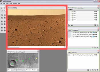
Viewer Window

- Image data is overlaid on a 3d terrain model and displayed as a navigable space
- User can pan, rotate, and zoom using the mouse
- Cursor changes to indicate action
- Interaction mechanism similar to QuickTimeVR
- Multiple views can be opened in the main window
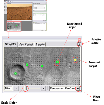
Navigator Window

- Overhead view of Mars provides spatial context to scientists
- Targets represent locations with navigable image data
- Selecting a target changes the Viewer window to that location
- Slider for adjusting map scale
- Filter for specifying classification of data products to be displayed
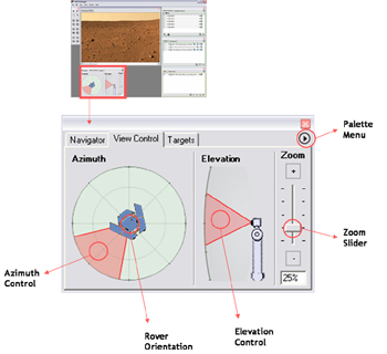
View Control Window

- Controls azimuth (direction), elevation and zoom of current view in the Viewer window
- Visually indicates the rover’s orientation when the navigable data product was captured
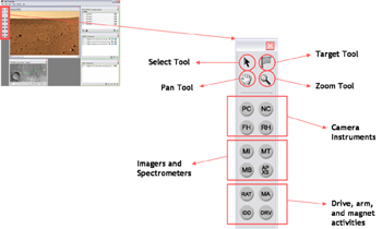
Activity Toolbar

- Tools for selecting, panning, zooming, and targeting
- Instrument tools for building activities in the interactive planning environment
