Solution
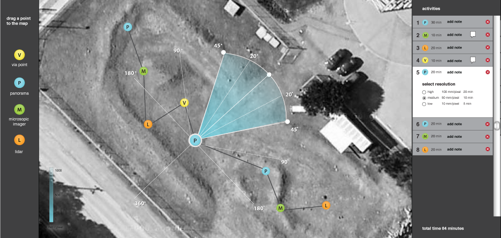
The system, at its core, is written in Flex and uses the Google Maps Flex API, Degrafa graphics library, and BlazeDS server, to provide an interactive, collaborative web environment to capture and communicate plan intent. The science team is often selected on short notice, and does not always contain the same members. With that in mind, we made a walk‐up‐and‐use interface that requires little to no training with the software. The main features are an activities list, a tool library, a notes field for entering intent information, and the ability to visualize and manipulate camera field of view.