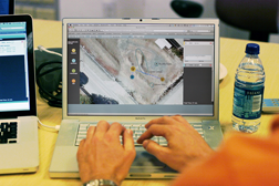
Proposed Workflow
Currently, scientists discuss the plan among themselves while an individual with technical expertise of the planning software generates a plan for them. This disconnect between the scientists and plan creation caused two problems. First, scientists did not communicate in a manner that provided useful inputs for the planning tool, and engineers needed time to interpret their requests. For example, scientists would often gesture with their hands the desired field of view for a panoramic image. Scientists would then wait while the person creating the plan translated this into specific camera settings including angle and resolution.
The second problem with not having a scientist create the plan was that the planning person would influence the points that were laid down. We witnesses the planner accidentally laying down points in the wrong location, and scientists would frequently correct the person There were also times when the person was not able to generate the plan at all because they were working on other tasks.
Our final design concept involves a major process change. We propose having a geologist actually create the plan so they can accurately represent their planning goals. This will give them the ability to indicate the rationale behind each point they add to the map so this intent is included in the plan itself. Not only will this help the flight team to interpret the plan during execution, but this will also allow the science team to refer back to such information during data analysis.


